
Table des matières
ToggleBelogorka Gorge, Kyrgyzstan
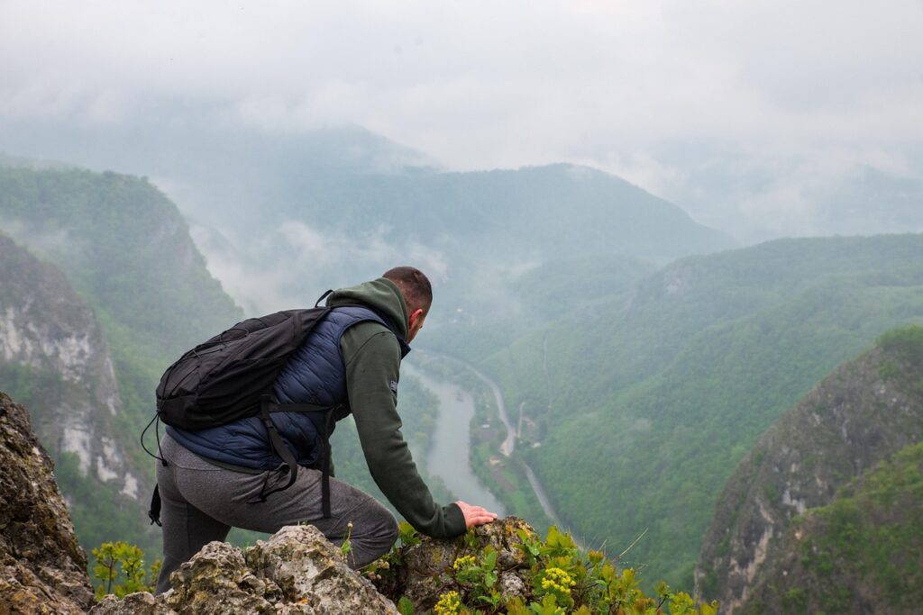
Belogorka is a mountain gorge in Chuy Region, southwest of Bishkek, known for its dramatic cliffs, the Sokuluk River, alpine scenery, and the approximately 60-meter Belogorka Waterfall. The area is also commonly known as Sokuluk Gorge, while the nearby settlement historically known as Belogorka is now called Tash-Bulak.
The waterfall is the main attraction and makes Belogorka a popular day-trip and hiking destination from Bishkek.
About Belogorka
Belogorka Gorge follows the Sokuluk River through the northern Tian Shan. The landscape changes from the lower valley into a rocky mountain gorge surrounded by steep cliffs, streams, alpine vegetation and mountain peaks.
The gorge is particularly known for its large waterfall, which drops approximately 60 meters and is one of the highest waterfalls in northern Kyrgyzstan.
At a Glance
Information | Details |
Type of Place | Gorge / Waterfall |
Location | Chuy Region, Kyrgyzstan |
Nearest major city | Bishkek |
River | Sokuluk River |
Main attraction | Belogorka Waterfall |
Waterfall height | Approximately 60 m |
Waterfall altitude | Approximately 2,100–2,200 m |
Visit type | Hiking / day trip |
Typical visit | Half day to full day |
Best season | Late spring to early autumn, depending on conditions |
Where Is Belogorka?
Belogorka Gorge is in Sokuluk District of Chuy Region, southwest of Bishkek.
Sources give different distances depending on the reference point and route, with figures around 70–80 km from Bishkek commonly reported.
The approach passes through the settlement of Tash-Bulak, which was historically known as Belogorka.
Belogorka Waterfall
The main attraction is the approximately 60-meter Belogorka Waterfall.
The waterfall is formed in the upper part of Sokuluk Gorge and drops through a steep rocky landscape. Because much of the falling water disperses into spray before reaching the bottom, the waterfall can appear as a large cloud of water from a distance.
The amount of water changes considerably through the year.
Spring and early summer can provide stronger flow from snowmelt, while the appearance of the waterfall depends on seasonal weather and precipitation.
Hiking to Belogorka Waterfall
The final approach to the waterfall is on foot along the Sokuluk River.
Travel sources describe the walking section as roughly 1–2 hours each way, depending on the starting point, route conditions and pace.
The route passes through a rocky mountain environment with sections beside the river.
Good hiking footwear is important because rocks and stream crossings can become slippery, particularly after rain or during periods of higher water.
Sokuluk River and Mountain Landscape
The Sokuluk River runs through the gorge between steep rocky slopes.
The landscape includes:
- rocky cliffs
- mountain streams
- alpine and subalpine vegetation
- grassy slopes
- forested areas
- mountain peaks
- seasonal wildflowers
The combination of the river, cliffs and waterfall makes the gorge particularly suitable for landscape photography.
Black Spire
One of the prominent mountain features visible from the gorge is a sharply shaped peak commonly referred to by tourism sources as Black Spire.
Its distinctive dark, pointed profile is one of the recognizable features of the Belogorka landscape.
Other Waterfalls
The Belogorka/Sokuluk area contains smaller waterfalls in addition to the main Belogorka Waterfall.
Some tourism sources describe several smaller cascades and waterfalls in the surrounding gorge.
How to Get to Belogorka
The usual approach is from Bishkek by road toward the Sokuluk area, followed by a drive into the gorge.
The final section of the excursion involves walking toward the waterfall.
A private vehicle, organized excursion or local guide can be used.
Road and trail conditions can vary after rainfall, and the final hiking section should be assessed according to current conditions.
Belogorka from Bishkek
Belogorka works well as a day trip from Bishkek.
A typical excursion consists of:
Bishkek → Tash-Bulak / Belogorka → Sokuluk Gorge → hike to Belogorka Waterfall → return to Bishkek
Depending on the transport and walking pace, the trip can take approximately half a day to a full day.
Best Time to Visit Belogorka
Late Spring and Summer
Late spring and summer can offer greener vegetation and stronger waterfall flow.
The waterfall’s appearance is particularly dependent on snowmelt and seasonal precipitation, so the strongest flow does not necessarily occur at exactly the same time every year.
Late Summer and Early Autumn
Late August and early September are traditionally highlighted by local tourism sources for the vegetation, berries and generally attractive mountain scenery.
After Heavy Rain
Extra caution is necessary after heavy rainfall.
The river can rise and rocks along the route can become slippery. Current local conditions should be checked before starting the hike.
Practical Information
- Wear sturdy hiking shoes.
- Carry enough drinking water and snacks.
- Bring a waterproof layer because of spray near the waterfall.
- Sun protection is useful on exposed sections.
- Expect uneven and rocky terrain.
- Be especially careful near the river and waterfall.
- Avoid approaching unstable cliff edges or wet rock faces.
- Weather in the mountains can change quickly.
- Check road and trail conditions before departure.
Belogorka and the Surrounding Chuy Mountains
Belogorka belongs to the mountain landscape southwest of Bishkek and lies west of Ala-Archa Gorge.
Although both areas provide access to the Kyrgyz Ala-Too, they should remain separate Sight entities:
Belogorka
→ Sokuluk River, waterfall and hiking route
Ala-Archa National Park
→ protected mountain landscape, major trekking routes and climbing areas
Places Near Belogorka
Related sights include:
- Ala-Archa National Park
- Bishkek
- Too-Ashuu Pass
- Vallée de Suusamyr
- Chunkurchak Gorge


