
Índice
ToggleSemenov Gorge, Kyrgyzstan
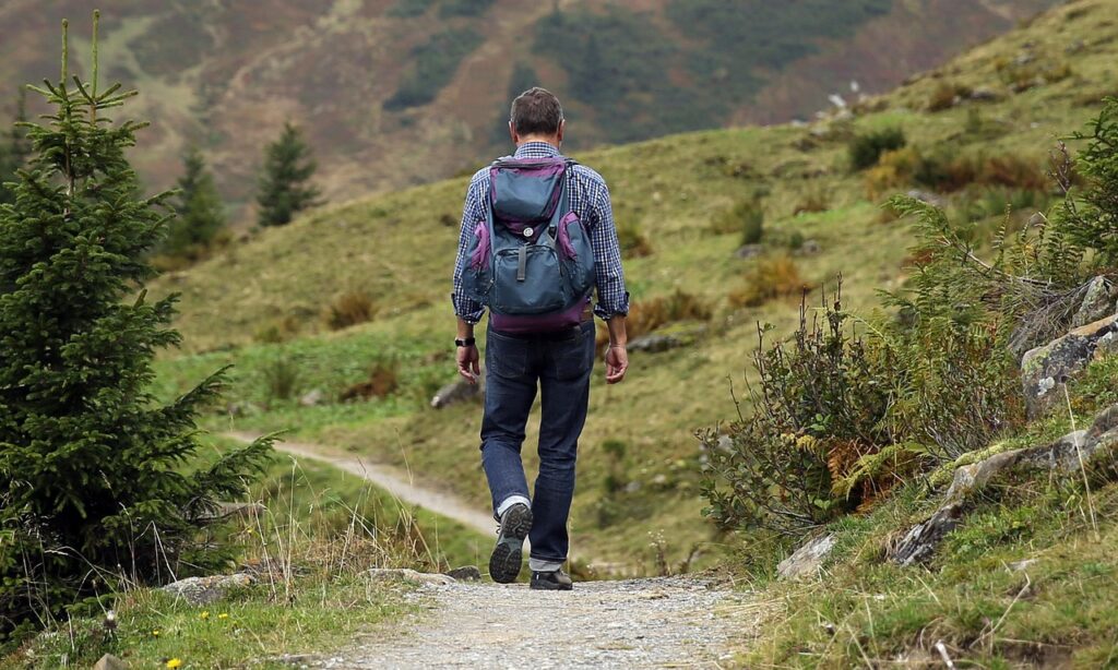
Semenov Gorge, also known as Semenovskoe Gorge or Kyrchyn, is a scenic mountain valley on the northern shore of Lake Issyk-Kul in eastern Kyrgyzstan. Located near the village of Semenovka, the gorge stretches into the Kungey Ala-Too mountains, with a landscape of spruce forests, mountain rivers, open alpine pastures and high-altitude scenery.
The gorge is a popular destination for travelers exploring the northern shore of Issyk-Kul. Visitors come to enjoy the mountain views, walk beside the river, experience traditional Kyrgyz pasture life and explore the valley on horseback or by vehicle. In summer, yurts and seasonal pasture camps add a cultural element to the natural landscape.
Semenov Gorge can be visited as a half-day excursion from Cholpon-Ata or combined with nearby Grigoriev Gorge for a longer day trip. Higher sections require more time and careful planning, especially if you want to reach mountain lakes or continue over the mountain road into the neighboring gorge.
What Is Semenov Gorge?
Semenov Gorge is a long mountain valley shaped by rivers flowing down from the Kungey Ala-Too range toward Lake Issyk-Kul. The valley extends for approximately 30 kilometers, although the distance visitors can comfortably travel depends on road conditions and their chosen route.
The lower gorge features a river, wooded slopes and open areas suitable for short walks. Farther into the mountains, the landscape becomes more open, with summer pastures, mountain streams and higher terrain.
The gorge is also associated with Kyrchyn, a pasture area used for traditional nomadic activities and cultural gatherings. Its combination of accessible scenery and deeper mountain routes makes it suitable for different kinds of excursions.
Where Is Semenov Gorge?
Semenov Gorge is located in the Issyk-Kul Region of northeastern Kyrgyzstan, near Semenovka village on the northern shore of Lake Issyk-Kul.
The entrance is reached from the main road connecting the northern-shore settlements of Balykchy, Cholpon-Ata and Karakol. From Semenovka, a road follows the river south into the mountains.
Approximate travel distances are:
- Cholpon-Ata: around 40 km
- Karakol: around 100 km
- Bishkek: around 300 km
Driving times depend on traffic, the exact starting point and how far you travel into the gorge. The lower approach is easier than the upper mountain tracks, where rough surfaces and changing weather can affect progress.
What to See in Semenov Gorge
Chon-Ak-Suu River
The river and its tributaries are central features of the gorge. Mountain water runs through the valley, passing rocky channels, meadows and wooded slopes.
The river provides attractive places for photography and short walks, particularly where the valley opens up. However, the water can be very cold and fast-flowing. Stay on stable ground and avoid crossing the river without a safe, established crossing.
Spruce Forests and Mountain Scenery
Spruce-covered slopes create a striking contrast with the open pastures and rocky mountains above them. Depending on how far you travel into the valley, you can experience shaded forest sections, riverbanks and wide views toward the surrounding ridges.
The changing scenery makes the gorge suitable for relaxed sightseeing as well as longer outdoor excursions.
Kyrchyn Pastures
Kyrchyn is associated with traditional summer grazing and Kyrgyz nomadic culture. During the warmer months, livestock and seasonal yurts may be seen in the pasture areas.
The valley also hosted cultural and sporting activities during the World Nomad Games, bringing traditional yurts, demonstrations and nomadic heritage into the international spotlight. Facilities and events vary by season, so visitors should not assume that a festival village or organised programme will be operating during every visit.
Sutuu-Bulak Lake
Sutuu-Bulak is a mountain lake associated with the upper Semenov Gorge area. Reaching it is a more demanding excursion than visiting the lower valley.
One local route guide describes a walk of approximately 5 km each way from the point where driving ends, with around 500 metres of elevation gain. Actual distance and difficulty depend on the starting point and trail conditions. Plan this as a dedicated hike rather than a quick roadside stop.
Mountain Pastures and Panoramic Views
Higher sections of the gorge open onto broad pastures surrounded by mountain ridges. These areas offer views of the Tien Shan landscape and a chance to see how the mountains are used for seasonal grazing.
Weather can change quickly at higher elevations, even when conditions beside Issyk-Kul are warm and sunny. Bring an extra layer and allow sufficient time to return before dark.
Hiking in Semenov Gorge
Semenov Gorge offers options ranging from short walks near the river to longer hikes toward mountain pastures and lakes.
For a relaxed visit, explore the lower valley and walk along a safe section of the river. This is a practical choice for families and travelers who want to experience the mountain landscape without committing to a long hike.
More ambitious visitors can plan a hike toward Sutuu-Bulak or explore upper sections of the valley with a local guide. Trails may be faint or unmarked, so offline navigation and local route information are useful.
For hiking, bring:
- Comfortable walking or hiking shoes
- Water and snacks
- A waterproof jacket and warm layer
- Sun protection
- An offline map
- A charged phone and, where appropriate, a power bank
Do not assume that every track shown on a map is a maintained hiking trail. If the weather deteriorates, turn back rather than continuing into exposed terrain.
Horseback Riding and Nomadic Culture
Horseback riding is one way to explore the mountain pastures around Semenov Gorge. Depending on the season, local providers may offer short rides or longer trips into the valley.
Visitors may also encounter yurts, livestock and other features of seasonal pastoral life. These are working landscapes as well as tourist destinations, so ask before entering private areas or photographing people at close range.
If you arrange a horse ride, confirm the price, duration, route and whether a guide is included before departure. Beginners should request a suitable horse and follow the guide’s instructions.
Semenov Gorge and Grigoriev Gorge
Semenov Gorge is commonly paired with nearby Grigoriev Gorge, another scenic valley on the northern shore of Issyk-Kul. Grigoriev Gorge is also known as Chon-Ak-Suu, while Semenov Gorge is associated with Kyrchyn and the Semenovka valley.
Both gorges offer mountain rivers, forested slopes and summer pastures, but they are separate valleys with different access roads.
A combined trip may be possible via a mountain road connecting the upper areas. However, this is not simply a paved road between two attractions. Gravel surfaces, stream crossings and damaged bridges can make the route difficult, especially after heavy rain. Check current conditions locally before attempting the crossing, and consider visiting each gorge separately if the road is uncertain.
How to Get to Semenov Gorge
From Cholpon-Ata
Cholpon-Ata is a convenient base for visiting Semenov Gorge. The drive to the entrance takes roughly 45–60 minutes in typical conditions, followed by additional driving time inside the valley.
You can travel by private car, arrange a taxi or book an organised excursion. If you hire a taxi, agree in advance on how far the driver will go into the gorge, how long they will wait and where the return pickup will take place.
From Karakol
From Karakol, follow the northern-shore road toward Semenovka village. The journey to the gorge entrance is approximately 100 km and commonly takes around two hours or more, depending on road conditions and stops.
From Bishkek
From Bishkek, follow the road toward Lake Issyk-Kul and continue along the northern shore to Semenovka. Allow roughly five to six hours for the drive, with additional time for stops and exploration.
Road Conditions
The lower approach is generally more accessible than the upper valley. Parts of the route transition from paved road to gravel or earth tracks, and conditions can deteriorate after rainfall or seasonal flooding. A high-clearance vehicle may be necessary for some upper sections.
Do not attempt a river crossing or continue over a damaged bridge simply because a navigation app shows a through-route. Check road conditions before departure, especially if planning to connect Semenov Gorge with Grigoriev Gorge.
Best Time to Visit Semenov Gorge
Summer, from June to September, is generally the most practical season for sightseeing, horseback riding and exploring the mountain pastures. Seasonal yurts and visitor services are more likely to be available during this period.
Spring brings fresh vegetation and flowing streams, but snowmelt and rain can make mountain roads muddy or difficult.
Autumn offers changing colours and cooler conditions, while many seasonal services may close as the grazing season ends.
Winter visits require more preparation because snow, ice and limited daylight can restrict road access and hiking options. Check local conditions before setting out.
Practical Information
- Location: Near Semenovka village, Issyk-Kul Region, Kyrgyzstan
- Type: Mountain gorge and valley
- Nearest major tourist base: Cholpon-Ata
- Recommended visit: Half a day for the lower valley; a full day for a longer hike
- Main activities: Sightseeing, hiking, photography, horseback riding and experiencing seasonal pasture life
- Best season: June–September
- Road: Paved sections near the entrance, with rougher tracks farther into the gorge
Mobile coverage can become unreliable in the upper valley. Download an offline map, arrange your return transport in advance and tell someone your intended route.
Avoid hiking or driving into narrow river channels during thunderstorms or prolonged rain. Keep a safe distance from livestock and do not leave rubbish behind.


